Albuquerque’s Historic Red Light District (Part 4): Learning and Using GIS

For those of you who are not familiar with the term GIS, it stands for Geographic Information Systems, a computer-based system designed to capture, manipulate, and present geographic data in visual form. It is now the most common basis for creating modern maps. It is probably familiar to most Americans through the use of GPS (Global Positioning System) navigation systems available in cars, trucks, boats/ships, and increasingly in smart phones. GIS and GPS are not the same thing, but both use satellite positioning to locate coordinates on Earth’s surface (click on the red links for more information on each system).
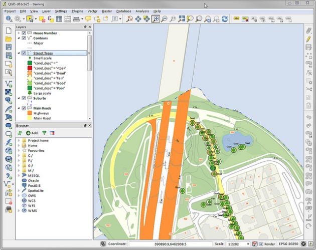
ImageScreen shot of a GIS software program – in this case, QGIS.

If you have been following this blog, you know that I am learning how to construct digital maps in order to reconstruct a visual representation of Albuquerque’s historic Red Light District, which disappeared sometime in the first half of the 20th Century. That means that I have to learn to use a GIS program, and probably learn a bit of programming.

Recently I started to learn how to use QGIS, a powerful and flexible GIS program. QGIS is an open source alternative to proprietary GIS software systems like ArcGIS by ESRI. QGIS can be used on a PC, Mac, or Linux platforms (unlike ArcGIS, which can only be used with Microsoft Windows). In addition, since QGIS is open source, there are no licensing fees – an important consideration for my mapping project, since the funding for the project will be scarce at best. One other thing: by using QGIS instead of other proprietary GIS programs, my mapping project will be supporting the free-flow of ideas and an intellectual commons that is open not just to users, but also to anyone capable of making a useful contribution to GIS technologies – even without having to jump through academic hoops and hoopla.

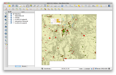
Screen shot 2013-10-24 at 11.05.04 AM

Here is a screen shot of my first QGIS map – New Mexico!!

To begin my studies, I followed a tutorial available on the blog, Geospatial Historian, which is maintained by a group of scholars located in Canada. Conceptually, QGIS was a little difficult to wrap my head around (I’m still struggling a bit), and like all software GIS technologies have their own unique terminology. Luckily, I was invited by my colleague Elena Friot to attend a GIS workshop given by Dr. Karl Benedict, assistant professor in the Earth Data Analysis Center at the University of New Mexico. Dr. Benedict gave a very clear introduction to the basics of GIS. This made my own efforts with QGIS much more productive. I am looking forward to learning more.

DSC_0037Our GIS workshop at the Earth Data Analysis Center, University of New Mexico

Albuquerque’s Historic Red Light District (Part 3): Searching for Prostitutes in the US Census of 1850

The most basic aspect of the Albuquerque Red Light District Project is the location and collection of data. Even though this is a digital mapping project, the data that informs the map exists mostly in archival records – paper and microfilm. That means trips to archives and libraries in order to access documents that contain necessary data. Once that data is located, the task is to make sense of it in way that demonstrates the transformation and eventual disappearance of legal, regulated prostitution in Downtown Albuquerque from 1850 to 1950.

This week I began the process by going through the US Census of 1850. All censuses from New Mexico (including Mexican and Spanish Imperial censuses) are housed at The Center for Southwest Research, a massive archive located at Zimmerman Library on the campus of the University of New Mexico. The census has been transferred to microfilm, which is a roll of film containing photo images of the actual handwritten census pages taken in 1850. My current task is to go through the entire census for Albuquerque, or (in the case of the 1850 census) Bernalillo County, and see if there are any women listed as prostitutes – especially if there are more than one living together in the same household. That would suggest a possible brothel.

ImageZimmerman Library, University of New Mexico (2013)

ImageThe Center for Southwest Research, Zimmerman Library, University of New Mexico (2013)

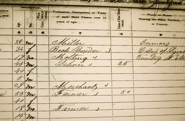
As I find listed prostitutes and probable brothels in the census, I type the data into a Microsoft Excel spreadsheet. If you look at the images below, you will see that the census not only gives the location of a household, but also the name, age, sex, and birthplace of each resident, as well as the size of any real estate held. So there is a lot of data that can be gleaned from the census tables. It tells us a lot. One of the difficulties in a census from the mid-19th century, is it only notes the profession of males over the age of 15. Later censuses noted the profession men, women, and children. So, if no prostitutes are listed in the 1850 census (like they are in the 1900 census), it cannot be because they were not there. Surely they were. The question is, why weren’t they counted? One answer might be that since this was the first US Census taken after the Mexican-American War (1846-1848), it was a census taken by a Imperial conqueror who is taking stock of who and what can be taxed – much like William the Conqueror did in England with the Domesday Book in 1086. Just a thought.

ImageNotice that the US Census of 1850 only listed the profession of males over the age of 15.ImageNote that skilled professionals often came from Europe, like the 38 year-old miller from Germany, and the 36 year-old bookbinder from France – a woman!!

Whether or not I locate prostitutes or brothels in the 1850 census, there are many things that the US Census makes clear about the New Mexico Territory in 1850. First, this was an agricultural world populated by poor famers, small time sheepherders, unskilled laborers, domestic servants, and their families. There were wealthy landowners, but not many. One of the largest landholders was the Church (5000 acres). Most of the skilled and professional men were immigrants from Western Europe, who perhaps were intent on making their fortune in the Far West. In 1850, Albuquerque was not much more than a collection of adobe houses and shops, surrounded by farms and irrigation ditches. The largest building was the Church of San Felipe de Neri (built 1706). It is likely that he American deputy who took the census was not familiar with the mostly Spanish-speaking people and their culture. Maybe he was not able to recognize sex workers; or maybe he chose to ignore them. Add to that, the hostility that men have historically directed towards women in general, and poor women in particular. Maybe women who traded sex for money, goods, and services were morally “invisible,” which justified their virtual absence. Whatever was the case in 1850, prostitutes were there, I am almost certain. But, can I find documentation to confirm it? That is the task.